Agency: United States Geological Survey (USGS)
Name: Volcano Alert Level
The aviation VAL scheme can be found here, and follows the standard ICAO aviation VAL scheme.
Elements of VAL system
| Domain | Terrestrial |
| Volcano | All |
| Scheme range | 4-level scale |
| Lowest level | 1 |
| Highest level | 4 |
| Level name type | Word |
| Level for lack/loss of monitoring | Yes |
| Volcanic activity | Yes |
| Hazards possible | No |
| Locations affected | No |
| Potential impacts | No |
| Forecast language | Yes |
| Timing language | Yes |
| Actions to take | No |
| Agency actions | No |
| Link to evacuations | No |
| Reporting frequency per level | No |
| Link to monitoring thresholds | No |
| Step-up and step-down language | Yes |
VAL sources and links
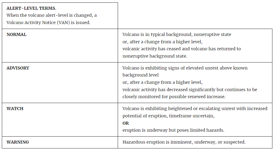
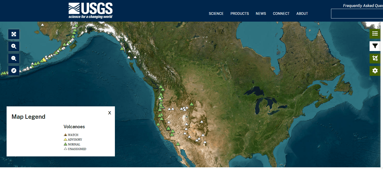
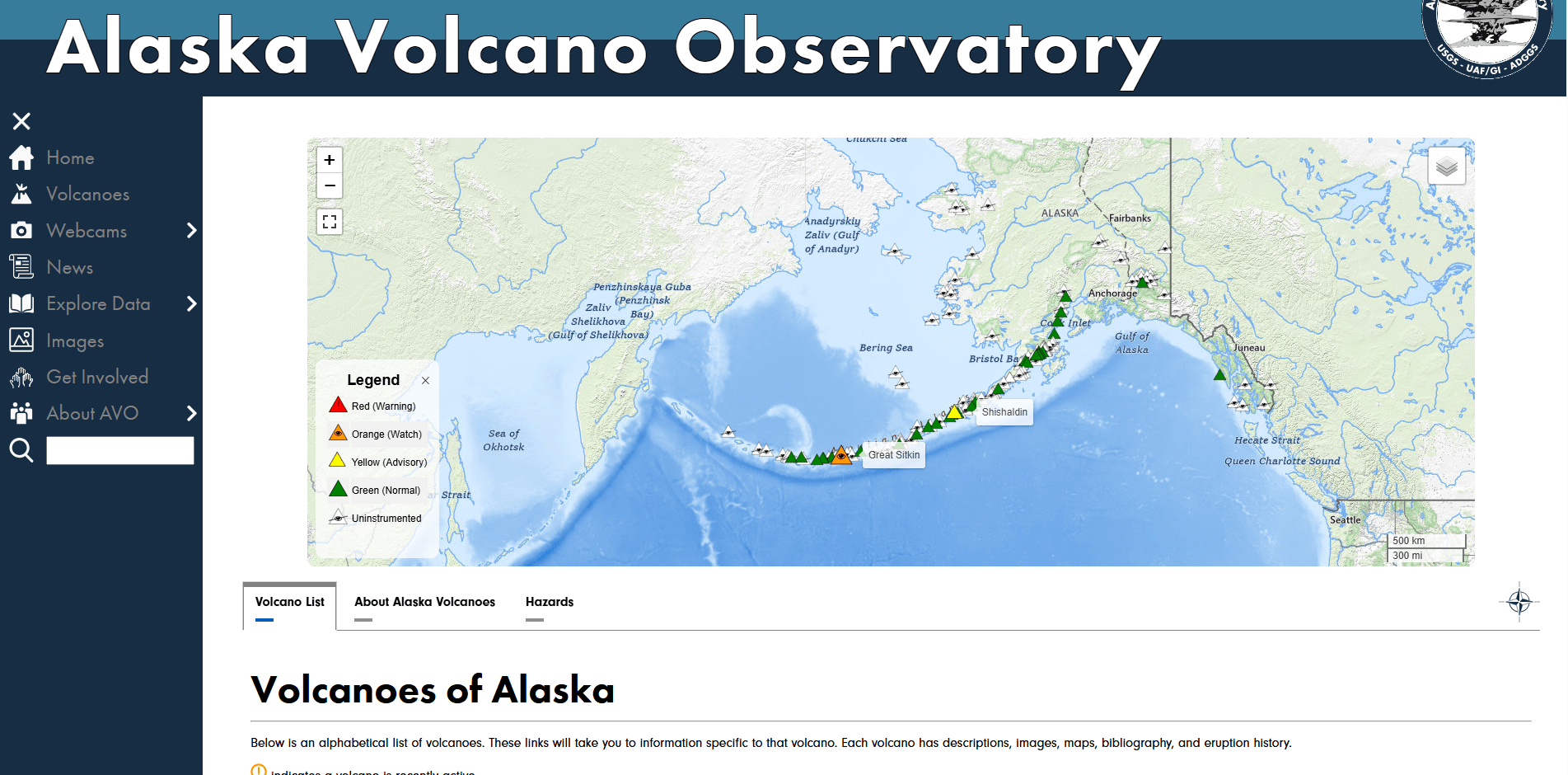
The images below are static examples of VAL information pages and DO NOT represent current alert levels. While we strive to maintain the links below, they may not always work. For the current alert level, please consult the proper institutional authorities.
VAL Dashboard

Reports

VAL Map
VAL Dashboard and Map (Alaska only)
Volcano Page

Social Media

Related References
Fearnley, C. J., McGuire, W. J., Davies, G., & Twigg, J. (2012). Standardisation of the USGS Volcano Alert Level System (VALS): analysis and ramifications. Bulletin of Volcanology, 74(9), 2023-2036. https://doi.org/10.1007/s00445-012-0645-6
Gardner, C.A. and Guffanti, M.C. (2006). U.S. Geological Survey’s Alert Notification System for Volcanic Activity. US Geological Survey Fact Sheet 2006–3139, US Geological Survey, Reston, VA. https://doi.org/10.3133/fs20063139