Agency: Montserrat Volcano Observatory (MVO)
Name: Hazard Level System
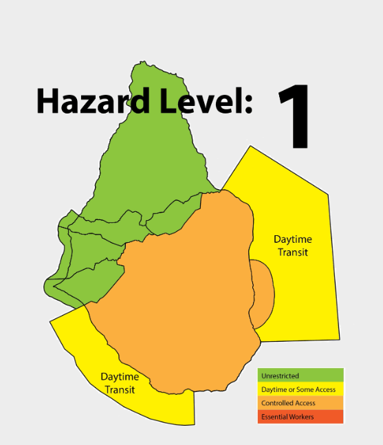
Note: This is a joint administrative VAL and hazard map system. Hazard maps using this system include: MVO (unknown year), MVO (2011), MVO (unknown year), and the map seen below, MVO (2014).

Elements of VAL system
| Domain | Terrestrial |
| Volcano | Soufrière Hills Volcano |
| Scheme range | 0–5 level scale |
| Lowest level | 0 |
| Highest level | 5 |
| Level name type | Access, Word, & Number |
| Level for lack/loss of monitoring | No |
| Volcanic activity | Yes |
| Hazards possible | Yes |
| Locations affected | Yes |
| Potential impacts | No |
| Forecast language | No |
| Timing language | No |
| Actions to take | Yes |
| Agency actions | No |
| Link to evacuations | Yes |
| Reporting frequency per level | No |
| Link to monitoring thresholds | No |
| Step-up and step-down language | No |
VAL sources and links
The images below are static examples of VAL information pages and DO NOT represent current alert levels. While we strive to maintain the links below, they may not always work. For the current alert level, please consult the proper institutional authorities.
Hazard Map
Social Media
