Agency: Japan Meteorological Agency (JMA)
Name: Volcanic Warning System (Submarine volcanoes)
The VAL system for volcanoes with numbered alert levels can be found here and the VAL system for volcanoes without numbered alert levels can be found here.
Japanese Hazard Maps are often linked to or display VAL information. These can be found here.

Elements of VAL system
| Domain | Maritime |
| Volcano | Submarine volcanoes |
| System range | 2-level scale |
| Lowest level | 1 |
| Highest level | 2 |
| Level name type | Word |
| Level for lack/loss of monitoring | No |
| Volcanic activity | No |
| Hazards possible | No |
| Locations affected | Yes |
| Potential impacts | No |
| Forecast language | Yes |
| Timing language | No |
| Actions to take | No |
| Agency actions | No |
| Link to evacuations | No |
| Reporting frequency per level | No |
| Link to monitoring thresholds | No |
| Step-up and step-down language | No |
VAL sources and links
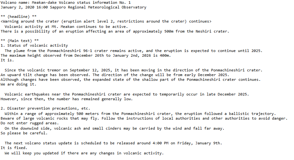
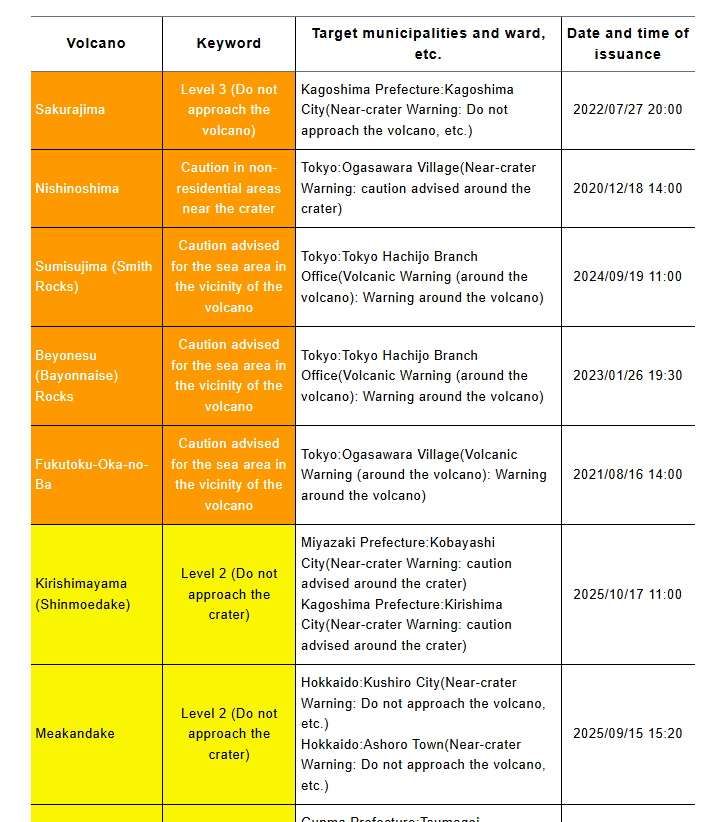
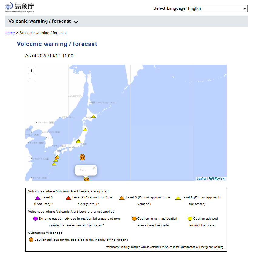
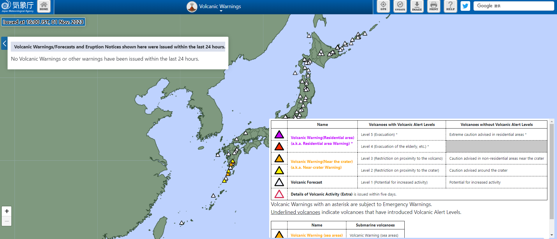
The images below are static examples of VAL information pages and DO NOT represent current alert levels. While we strive to maintain the links below, they may not always work. For the current alert level, please consult the proper institutional authorities.
VAL Map and Dashboard
VAL Map
Reports