Agency: Center for Volcanology and Geological Hazard/Pusat Vulkanologi dan Mitigasi Bencana Geologi (CVGHM/PVMBG)
Name: Tingkat Aktivitas Gunung Api [Volcanic Activity Level]
The aviation VAL system can be found here, and follows the standard ICAO aviation VAL system.
Indonesian Hazard Maps are often linked to or display VAL information. These can be found here.
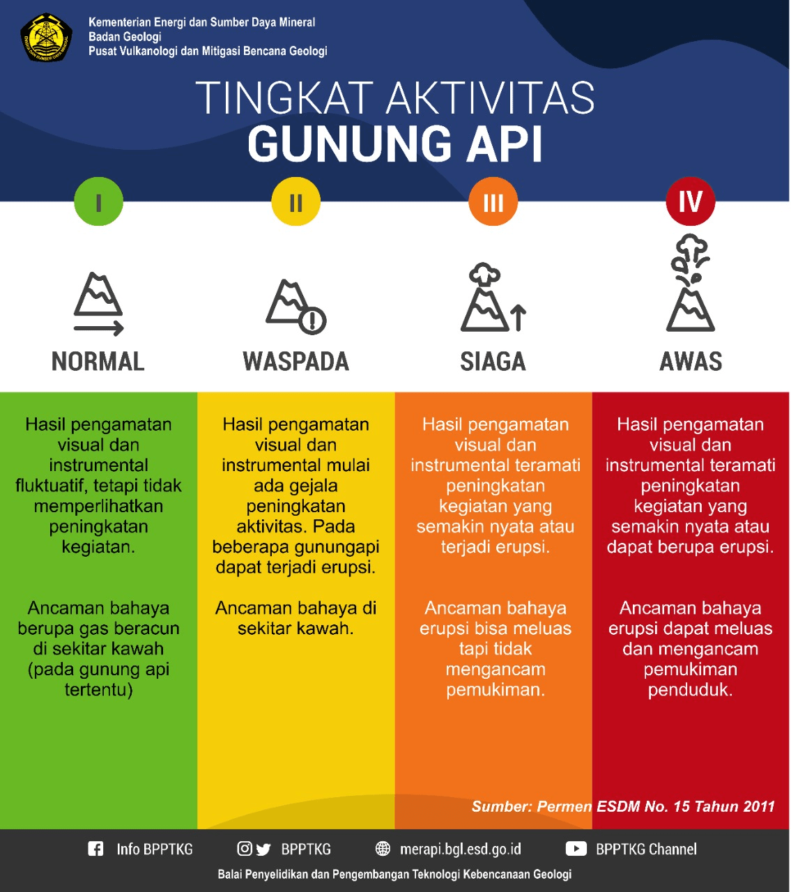
Elements of VAL system
| Domain | Terrestrial |
| Volcano | All |
| System range | 4-level scale |
| Lowest level | 1 |
| Highest level | 4 |
| Level name type | Number & Word |
| Level for lack/loss of monitoring | No |
| Volcanic activity | Yes |
| Hazards possible | Yes |
| Locations affected | Yes |
| Potential impacts | No |
| Forecast language | Yes |
| Timing language | No |
| Actions to take | Yes |
| Agency actions | No |
| Link to evacuations | Yes |
| Reporting frequency per level | No |
| Link to monitoring thresholds | No |
| Step-up and step-down language | No |
VAL sources and links
The images below are static examples of VAL information pages and DO NOT represent current alert levels. While we strive to maintain the links below, they may not always work. For the current alert level, please consult the proper institutional authorities.
VAL Dashboard

VAL Map

Reports


Social Media

Related References
Andreastuti, S., Budianto, A., & Paripurno, E. T. (2017). Integrating social and physical perspectives of mitigation policy and practice in Indonesia. In: Fearnley, C.J., Bird, D.K., Haynes, K., McGuire, W.J., Jolly, G. (eds) Observing the Volcano World. Advances in Volcanology. Springer, Cham. Publishing. https://doi.org/10.1007/11157_2016_36