Agency: Servicio Geológico Colombiano (SGC)
The aviation VAL scheme can be found here, and follows the standard ICAO aviation VAL scheme.
Elements of VAL system
| Domain | Terrestrial |
| Volcano | All |
| System range | 4-level scale |
| Lowest level | 1 |
| Highest level | 4 |
| Level name type | Color |
| Level for lack/loss of monitoring | No |
| Volcanic activity | Yes |
| Hazards possible | Yes |
| Locations affected | Yes |
| Potential impacts | Yes |
| Forecast language | No |
| Timing language | No |
| Actions to take | Yes |
| Agency actions | No |
| Link to evacuations | Yes |
| Reporting frequency per level | No |
| Link to monitoring thresholds | No |
| Step-up and step-down language | No |
VAL sources and links
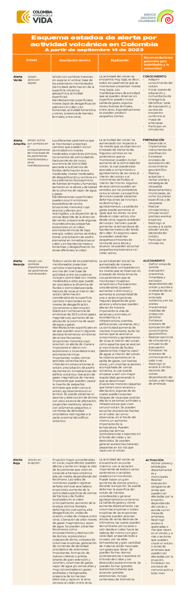
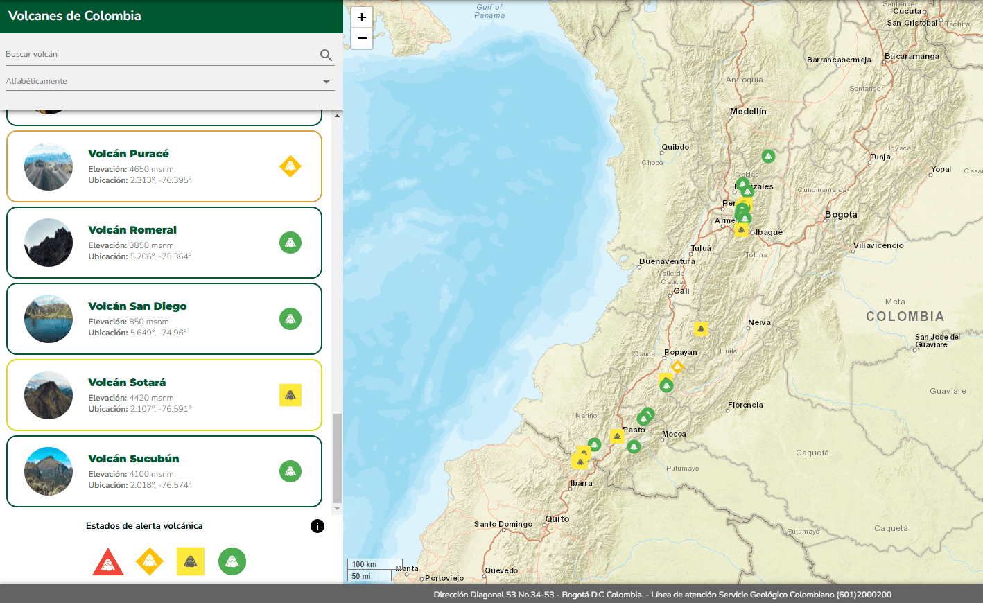
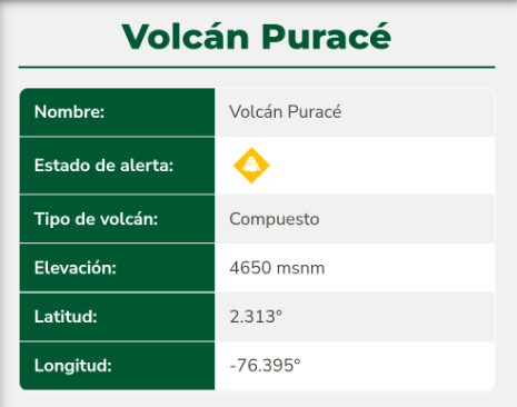
The images below are static examples of VAL information pages and DO NOT represent current alert levels. While we strive to maintain the links below, they may not always work. For the current alert level, please consult the proper institutional authorities.
VAL Map
Volcano Pages
Reports

Social Media

Related References
Servicio Geológico Colombia (SGC). (2023). Colombia cambia su esquema de medición de la actividad volcánica. Noticias. https://www2.sgc.gov.co/Noticias/Paginas/Colombia-cambia-su-esquema-de-medicion-de-la-actividad-volcanica.aspx
Servicio Geológico Colombia (SGC). (2023). Colombia cambia su esquema de medición de la actividad volcánica. Hoja Informativa. https://srvags.sgc.gov.co/PortalWeb/Comunicaciones/Esquema-de-medicion-de-actividad-volcanica-en-Colombia-SGC-Actualizacion-Mayo2024.pdf